You can’t literally see lights from space or whatever. If somewhere had less coverage on google maps you wouldn’t think it’s uninhabited, but for some reason, people irl seem to be constantly referring to this image as though it’s a literal picture. Mostly for ‘civilized’ reasons, but also light pollution and just other stuff. Maybe this just made the rounds on reddit or something?


It still seems way bigger than their energy production would require. That area is larger than all of Central Europe and just as brightly lit with a tiny fraction of the population.
to add to @Chronicon@hexbear.net’s comment, that region is quite far north and the image is mercator projection. the size is significantly exaggerated relative to lower latitudes, and 6 months of the year it’s “nighttime” so any industrial operations will need to be well lit.
oh wow can’t believe I didn’t even think of the fact that its like, arctic circle territory and spends so much of the year in darkness.
I mean, when has the fossil fuel industry ever cared about wasting energy or light pollution?
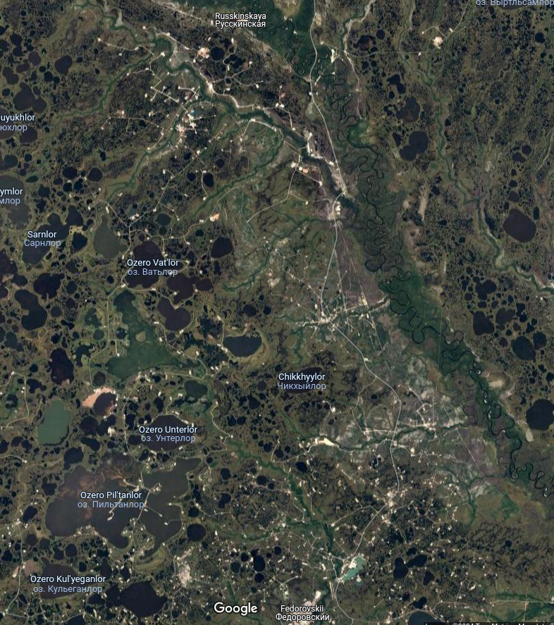
Here’s a satellite view of like a 50km square (very ballpark) area:
every one of those white spots is some sort of extraction site, an oil/gas well, or a mine, or whatever, probably like 5 football fields in area minimum, and probably all brightly lit 24/7