- 669 Posts
- 223 Comments


 3·5 days ago
Curiosity drove on sol 4287, moving to the north and retracing its path, and is now back at the sol 4251 location.


 2·10 days ago
I personally don’t care about long winded posts, I think you’ll find those that are seeking a deeper understanding will not care either. There will always be those who will want a TLDR post, but you can leave that to others to condense :)
Look forward to your posts (whenever you have time) :)
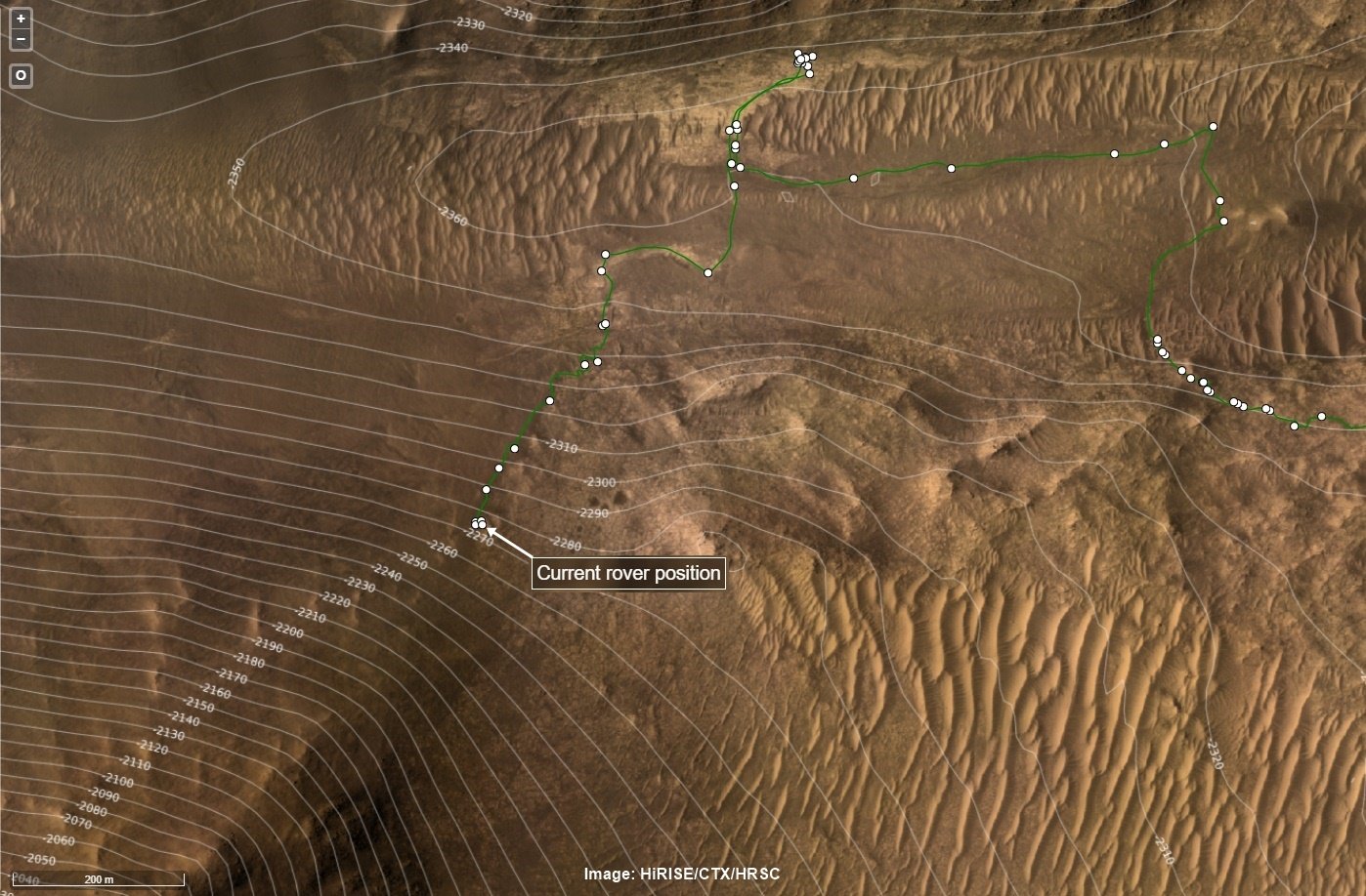
point-to-point 1419.73 meters (using the coordinates), but a tad further as the rover is climbing the rim now.
The rover is now 101.06 meters higher than the rover and that adds 0.27 meters to the point to point distance which is 1420.0 meters :)
The point-to-point distance between the helicopter and the rover at the locations shown on this image is 1419.7 meters (4657.7 feet)
The crater rim rises to a max of 590 meters from the floor of Neretva Vallis that carves through the rim. But the rover has options to cross the rim at a little less than that depending on conditions encountered on the traverse. It’s a steep climb with sections around 23% slope angel.
The ChemCam is a fancy camera with an in-built laser, the camera has a telescopic lens. ChemCam can be used in a few different ways. It can zap a rock with its laser which generates a small flash of light, the flash of light has different colours depending on the minerals in the rock, that helps the science team understand what the rock is made of, it can also check the sunlight reflected off the rock without using the laser but that is less accurate. In this case they did not use the laser or the reflected sunlight, they just pointed the telescopic camera high up the mountain and snapped a series of photos of some really rugged terrain that the science team hope the rover can visit one day in the future after it drives higher up the mountain.
Love it when knowledgeable folk join the chat :) It takes these posts to a whole new level :)
I’m not a geologist, but from what I understand the red colour is a good indicator of iron and oxygen at the time the sediments were laid down.
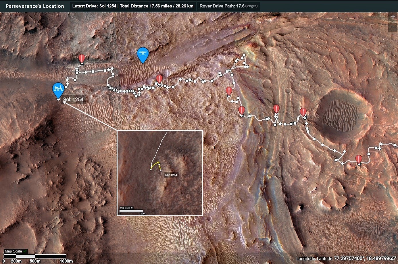
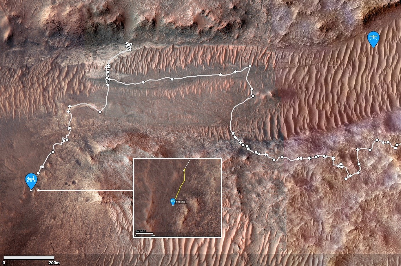
The current location is Serpentine Rapids in the upper right of the map (North is up)
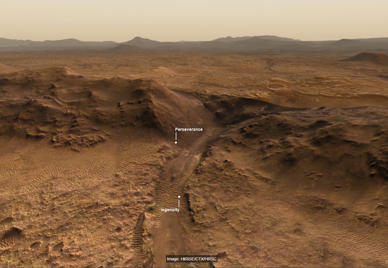
The route (shown in blue) that the agency’s Perseverance Mars rover is expected to take as it climbs up the western rim of Jezero Crater is superimposed on this image taken by the HiRISE camera aboard NASA’s Mars Reconnaissance Orbiter.
At upper right is “Serpentine Rapids,” the final geologic location of interest for the Perseverance science team before the rover begins its ascent. “Dox Castle” is a region the science team would like to explore during the rover’s ascent. Two of the first regions the science team wants study at the top of the crater are “Pico Turquino” and “Witch Hazel Hill.”
Imagery from NASA’s Mars orbiters indicates that Pico Turquino contains ancient fractures that may have been caused by hydrothermal activity in the distant past. Orbital views of Witch Hazel show layered materials that likely date from a time when Mars had a very different climate than today. Those views have revealed light-toned bedrock similar to what was found at “Bright Angel,” the area where Perseverance recently discovered and sampled the “Cheyava Falls” rock, which exhibits chemical signatures and structures that could possibly have been formed by life billions of years ago when the area contained running water.
The distance the rover will drive to get from Serpentine Rapids to the Aurora Park/Pico Turquino area is about 1.1 miles (1.8 kilometers); the change in elevation between the two locations is about 980 feet (300 meters). The distance covered to go from Aurora Park/Pico Turquino to Witch Hazel Hill is about 1.2 miles (2,000 meters) and the change in elevation is about 820 feet (250 meters).
I read somewhere that the geometry of the capsule was designed in such a way that it was guaranteed to result in the rover being upright after bouncing. I have now idea how they guaranteed that or if they could have righted it if it was not upright :)
The smaller rovers that landed inside an inflated balloon was also crazy, but proved to be effective… I wonder what future (larger) rovers will employ for a landing system :)
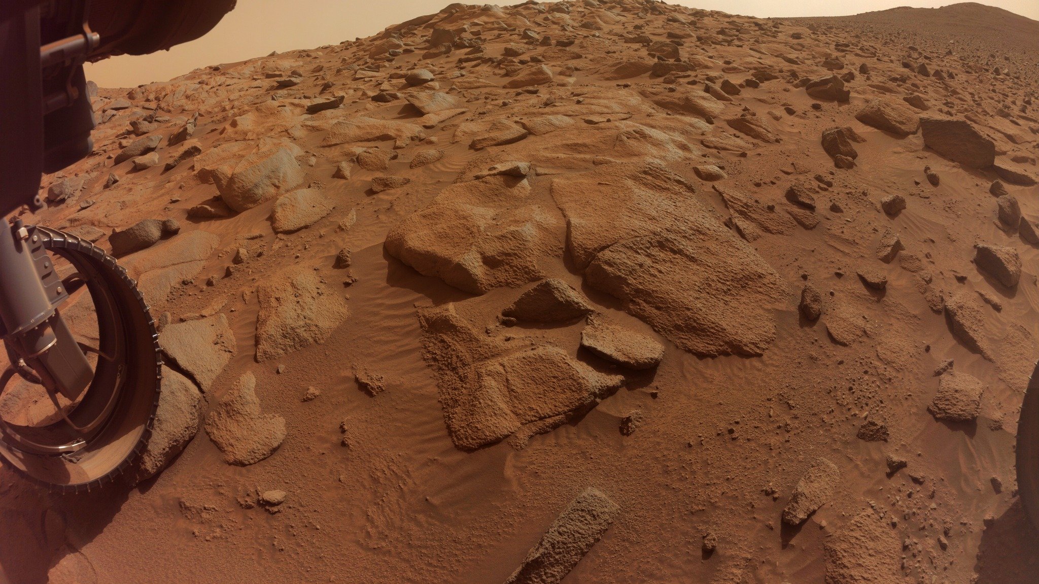
Try zooming in and check out the fringing at the edges of many of those rocks. They are ventifacts, carved by the by wind blown sand over eons. Ventifacts are formed by aeolian processes, hence the title. ☺️
Its feature rich and if you get stuck with a tech problem the help team are amazing. Be warned it’s a rabbit hole, once you go in you won’t be seen for weeks 😁
There is an official M2020 blog, but it is really woeful in being updated, when compared with the Curiosity blog. The Curiosity blog has detailed blogs about activities for just about every sol since landing (12 years ago) and all are on their mission page. The M2020 blog is rarely updated. There are mission managers reports (almost daily) available in the mission PDS that you could read, but they are only updated every three months, and the newest ones are ~6 months old. So if you want to read about things that occurred between landing and 6 months ago the you can view lots of stuff using the Analysts Notebook
Analysts Notebook - https://an.rsl.wustl.edu/ (all missions)
M2020 blog: https://mars.nasa.gov/mars2020/mission/status/
MSL blog: https://science.nasa.gov/mission/msl-curiosity/science-updates/
AFAIK - No internationally agreed standard, but a bunch of formats have been proposed.
They do have some elements like Local Mars Solar time (LMST) that can be calculated for any spot on Mars, these have been used by a number of nations that have sent hardware to the surface
There’s an in-depth Wikipedia page on Timekeeping on Mars, it covers things like proposed date systems as well as calendars. I would assume that the first human settlers to arrive on the planet Mars would select the system that suited them best before departure. I also assume any settlers that arrive later would likely follow what is already in place, rather than use a different system.
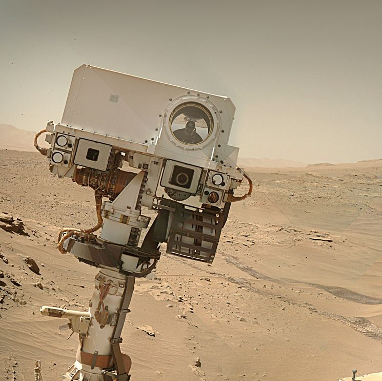
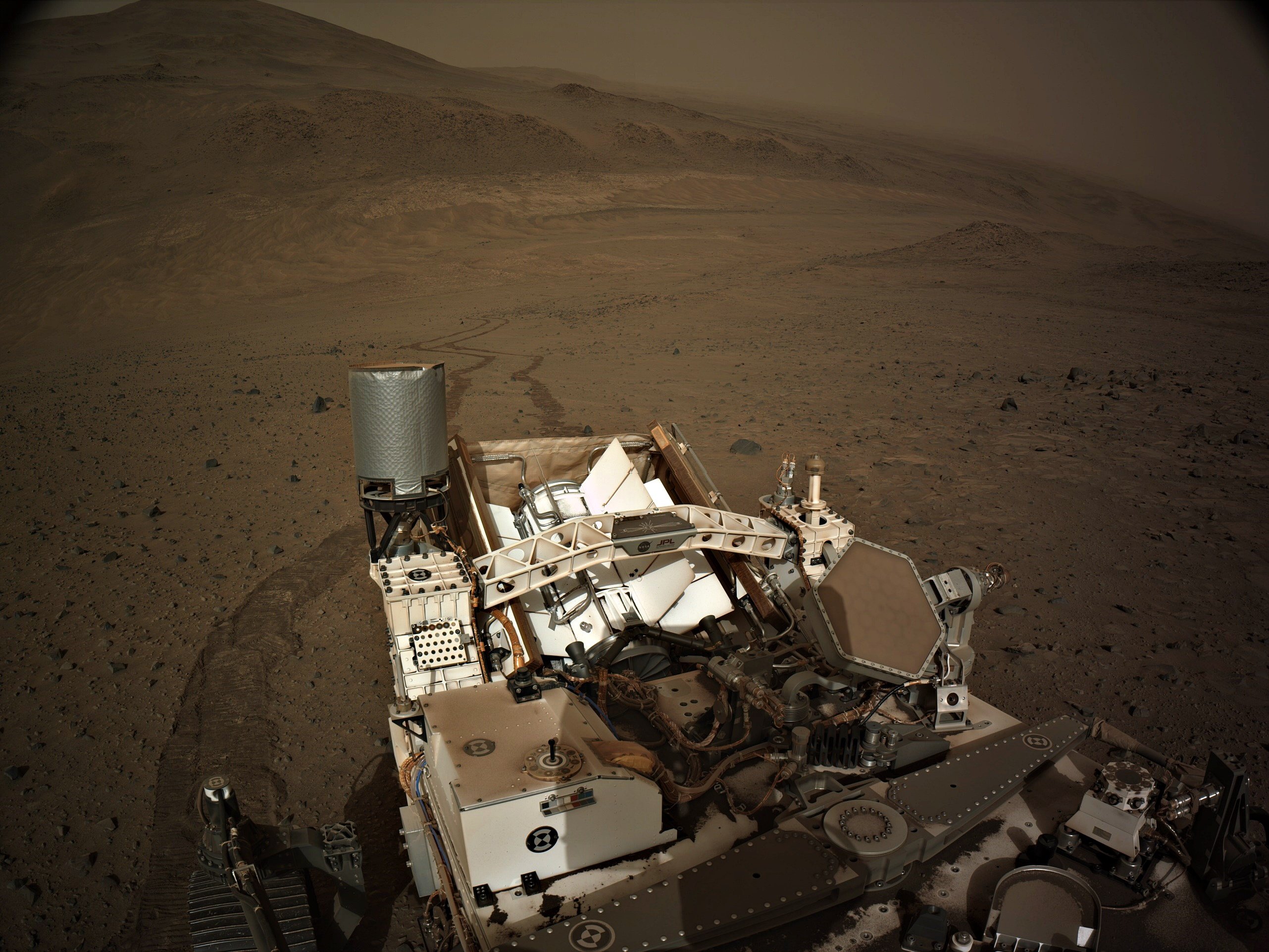
The RMI is basically a fancy telescope, hence the rounder images, its depth of field is also very small, so on target like this they often appear larger :)
Yes, that’s blog is referring to Earth-years - Some (like me) also celebrate birthdays in Mars-years, but they are not normally celebrated by the team in formal News releases, but they are usually mentioned in Curiosity’s mission blogs. Probably less celebrated because the Mars date system is sort of complicated.
IIRC - The rover celebrated 6 Martian Years on November 18, 2023.
I guess the world will have to wait for those future boots on the ground at the Mars 3 landing site to see if the rover was deployed. Deep down I hope it did get deployed and roved, even it was only a few centimeters / inches. Those boots will be long after I am pushing up the daisies, as I’m already older than dirt… :) But the young ones that follow these exploits on Mars will get to see what happened… :)
AFAIK - The Russian space agency never provided an update on them. Pity, I’d like to have seen them operate ☺️
Sojourner and Zhurong? :)
PrOP-M - 0 ft
Sojourner - 330 ft
Zhurong - 6,302 ft (~1.2 miles)
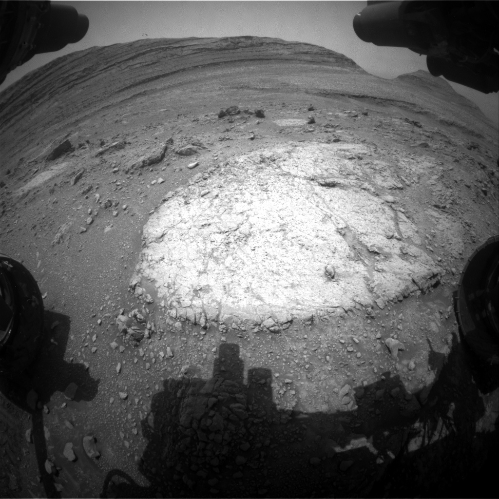
They are small ripples in the soft sand between rocks, if you look in the NavCam images of the workspace on sol 1254 you can see many more examples.
These ripples are formed by the wind (aeolian process).