They mixed taxi and ride sharing with walking in that statistic. For the purposes of car usage, it’s not really helpful. That’s still one car for one person, on the road for the amount of time that person is commuting (i.e. it doesn’t park, it goes and picks up another commuter)
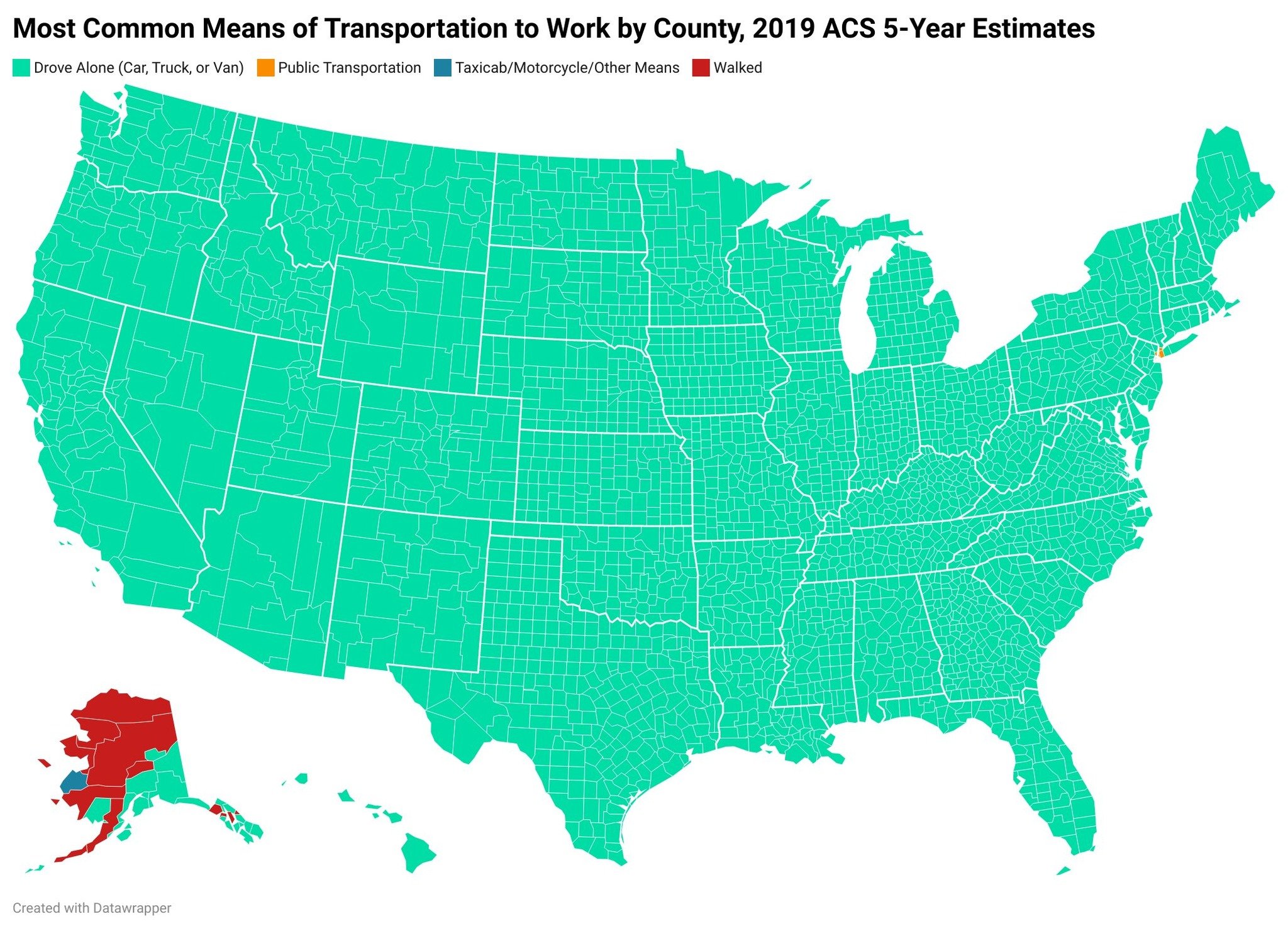
Moreover, difference in land mass and population density matters when looking at this from a national perspective. United States has significantly more rural space than Germany. The map posted is kind of pointless because it’s only showing the most used form of transportation in each county, and that will always be cars with extreme outliers like New York City, no matter how much we invest in public transportation.
What they’re using is Bumblefunk County Oklahoma to get from their little town of 2,000 people to the factory 20 minutes away in some industrial park between Nowheresville and Chickentowm isn’t really relevant to the discussion. Public transportation is only really viable in dense areas, but everyone else in the country is going to still drive because they’ve got distance to cover or irregular routes. Even if we expanded rail across the country, people in those counties would still need to drive to the station.
I agree that both the map and the statistic I’ve posted don’t take those country-specific characteristics into account.
I’m not sure how important that difference really is, though, as both the US and Germany seem to have pretty similar degrees of urbanization (US: 83.3%; Germany: 77.8%; source). So the rural population isn’t really that big in either country, relatively speaking.
I’m not trying to say that the rural population isn’t a factor, I’m just not sure how big that factor really is.


They mixed taxi and ride sharing with walking in that statistic. For the purposes of car usage, it’s not really helpful. That’s still one car for one person, on the road for the amount of time that person is commuting (i.e. it doesn’t park, it goes and picks up another commuter)
Moreover, difference in land mass and population density matters when looking at this from a national perspective. United States has significantly more rural space than Germany. The map posted is kind of pointless because it’s only showing the most used form of transportation in each county, and that will always be cars with extreme outliers like New York City, no matter how much we invest in public transportation.
What they’re using is Bumblefunk County Oklahoma to get from their little town of 2,000 people to the factory 20 minutes away in some industrial park between Nowheresville and Chickentowm isn’t really relevant to the discussion. Public transportation is only really viable in dense areas, but everyone else in the country is going to still drive because they’ve got distance to cover or irregular routes. Even if we expanded rail across the country, people in those counties would still need to drive to the station.
I agree that both the map and the statistic I’ve posted don’t take those country-specific characteristics into account.
I’m not sure how important that difference really is, though, as both the US and Germany seem to have pretty similar degrees of urbanization (US: 83.3%; Germany: 77.8%; source). So the rural population isn’t really that big in either country, relatively speaking.
I’m not trying to say that the rural population isn’t a factor, I’m just not sure how big that factor really is.