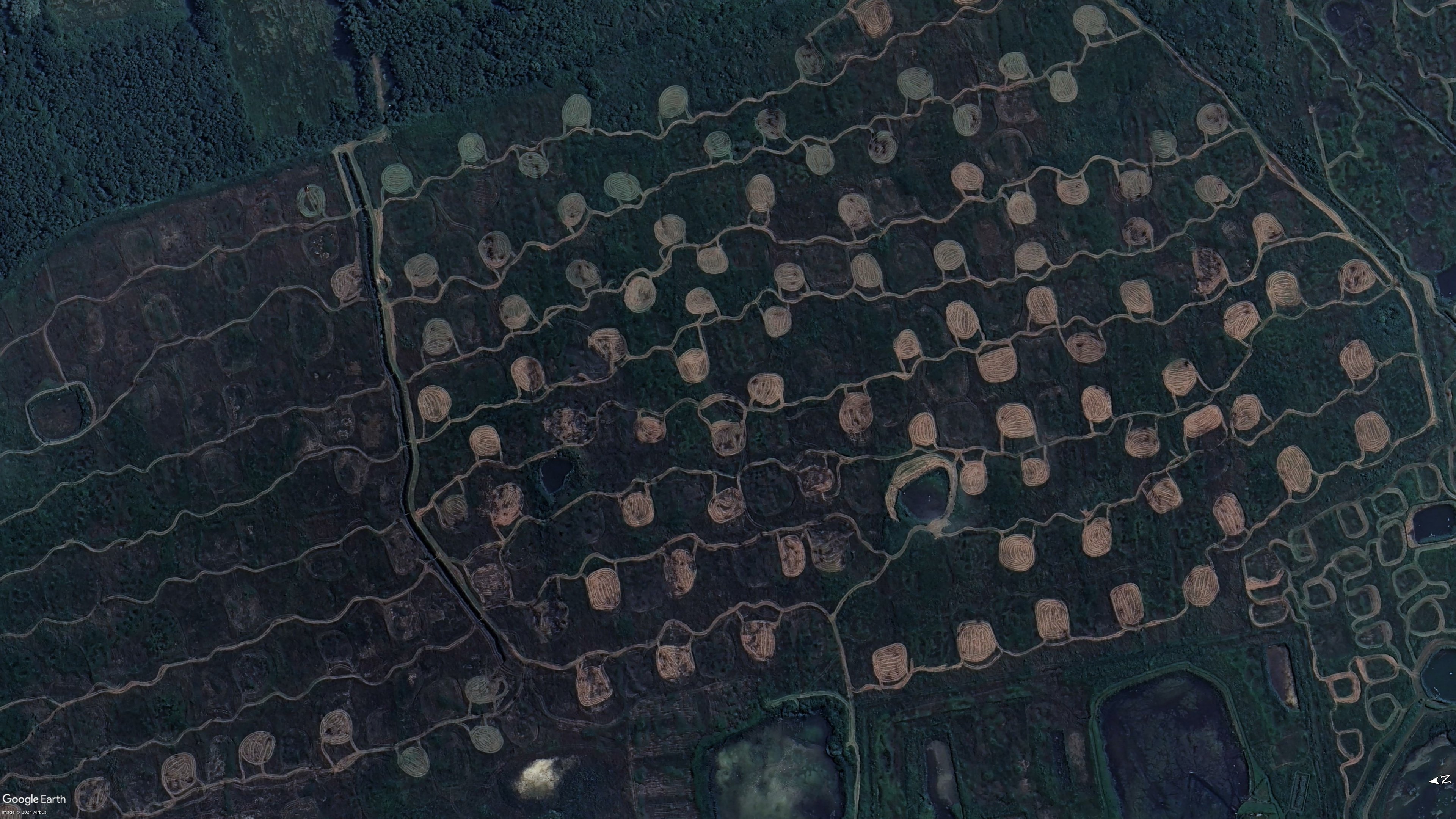
I found an explanation on a French blog. These shapes are called “Platières à bécassines”. Bécassine is the French for the wild bird “snipe”. The idea is to cut the grass/vegetation on some patches of the swamp in June (when it’s dry), so that when water comes back in the autumn it creates small ponds that snipes like. It’s for bird/duck hunting purposes basically.


I found an explanation on a French blog. These shapes are called “Platières à bécassines”. Bécassine is the French for the wild bird “snipe”. The idea is to cut the grass/vegetation on some patches of the swamp in June (when it’s dry), so that when water comes back in the autumn it creates small ponds that snipes like. It’s for bird/duck hunting purposes basically.
source